 vesseltracker.com
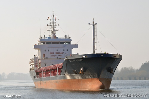
 SULTAN ATASOY
Current Status
Where is the vessel?
SULTAN ATASOY is currently in 81 nm N of Carino, based on AIS data received less than 1h ago.
Latest AIS update:
Current position: 45.00507° N, 8.47620° W (81 nm N of Carino)
Average speed (last 7 days): Loading…
Average speed (last 30 days): Loading…
Vessel profile: SULTAN ATASOY is a Bulk Carrier with dimensions 109m x 16m.
This page combines live AIS, route history, probable destination signals, nearby traffic, and port activity for practical vessel monitoring.
The current position of vessel SULTAN ATASOY is 45.00507 lat / -8.47620 lng. Updated: 2026-04-10 00:20:09 UTCNearest reference points:
- 57 nm S of Boboras
- 22 nm N of Carino
- 30 nm NW of Meiras-Valdoviño
Currently sailing under the flag of Liberia ![]()
SULTAN ATASOY built in 2010 year
Deadweight:
6634 tDetails:
Live Vessel SULTAN ATASOY Analytics (details, animations, etc.)
Recent AIS points (UTC):
2026-04-09 18:10:07 UTC · 44.22605, -9.04688 · SOG 7.9 kn · COG -1°2026-04-09 19:18:51 UTC · 44.36356, -8.93561 · SOG 8.6 kn · COG -1°
2026-04-09 21:21:21 UTC · 44.62784, -8.73517 · SOG 8.9 kn · COG 23°
2026-04-10 00:20:09 UTC · 45.00507, -8.47620 · SOG 8.2 kn · COG -1°