 vesseltracker.com
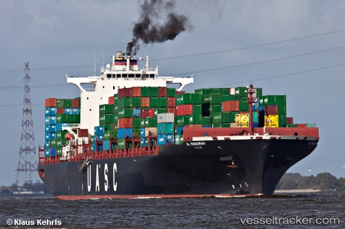
 AL MANAMAH
Current Status
Where is the vessel?
AL MANAMAH is currently in 17 nm N of Dunkerque, based on AIS data received about 2h ago.
Latest AIS update:
Current position: 51.31488° N, 2.21868° E (17 nm N of Dunkerque)
Average speed (last 7 days): Loading…
Average speed (last 30 days): Loading…
Vessel profile: AL MANAMAH is a Container Ship with dimensions m x m.
This page combines live AIS, route history, probable destination signals, nearby traffic, and port activity for practical vessel monitoring.
The current position of vessel AL MANAMAH is 51.31488 lat / 2.21868 lng. Updated: 2026-04-06 13:21:58 UTCNearest reference points:
- Near Dunkerque
- 15 nm E of RAMSGATE
- 13 nm NW of Middelkerke
Currently sailing under the flag of Liberia ![]()
Details:
Live Vessel AL MANAMAH Analytics (details, animations, etc.)
Recent AIS points (UTC):
2026-04-06 07:57:21 UTC · 51.52986, 1.91351 · SOG 0.5 kn · COG 88°2026-04-06 10:10:26 UTC · 51.53638, 1.90267 · SOG 1.8 kn · COG 21°
2026-04-06 12:10:07 UTC · 51.47172, 1.91196 · SOG 7.6 kn · COG 152°
2026-04-06 13:21:58 UTC · 51.31488, 2.21868 · SOG 10.3 kn · COG 112°