 vesseltracker.com
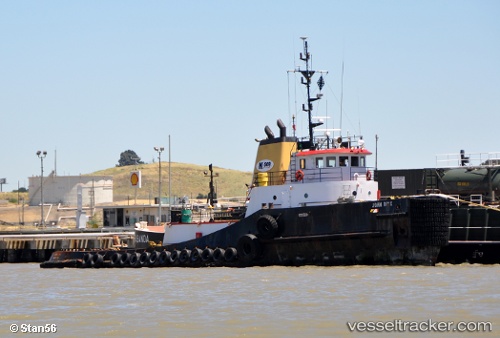
John Brix
Current StatusWhere is the vessel?
John Brix is currently in 17 nm W of Ocean Shores, based on AIS data received about 2h ago.
Latest AIS update:
Current position: 47.06089° N, 124.54959° W (17 nm W of Ocean Shores)
Average speed (last 7 days): Loading…
Average speed (last 30 days): Loading…
Vessel profile: John Brix is a Tug with dimensions 12m x 42m.
This page combines live AIS, route history, probable destination signals, nearby traffic, and port activity for practical vessel monitoring.
The current position of vessel John Brix is 47.06089 lat / -124.54959 lng. Updated: 2026-04-02 13:30:30 UTCNearest reference points:
- Near Grays Harbor City
- Near WARRENTON
- Near Grays River
Details:
Live Vessel John Brix Analytics (details, animations, etc.)
Recent AIS points (UTC):
2026-04-02 07:25:47 UTC · 47.47500, -124.70333 · SOG 4 kn · COG -1°2026-04-02 09:33:09 UTC · 47.33121, -124.64862 · SOG 4.1 kn · COG 165°
2026-04-02 12:10:48 UTC · 47.15500, -124.58333 · SOG 4 kn · COG -1°
2026-04-02 13:30:30 UTC · 47.06089, -124.54959 · SOG 4.2 kn · COG 173°