 vesseltracker.com
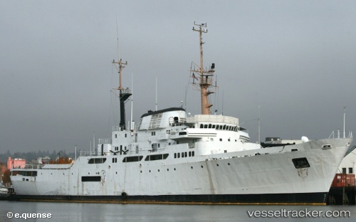
Mv Sahara
Current StatusWhere is the vessel?
Mv Sahara is currently in Near PENDIK, based on AIS data received about 4h ago.
Latest AIS update:
Current position: 40.83900° N, 29.21353° E (Near PENDIK)
Average speed (last 7 days): Loading…
Average speed (last 30 days): Loading…
Vessel profile: Mv Sahara is a Research Vessel with dimensions 18m x 92m.
This page combines live AIS, route history, probable destination signals, nearby traffic, and port activity for practical vessel monitoring.
The current position of vessel Mv Sahara is 40.83900 lat / 29.21353 lng. Updated: 2026-03-28 07:22:38 UTCNearest reference points:
- Near TUZLA
- Near PENDIK
- Near Tuzla Free Zone
Details:
Live Vessel Mv Sahara Analytics (details, animations, etc.)
Recent AIS points (UTC):
2026-03-28 01:25:35 UTC · 40.83830, 29.21438 · SOG 0.1 kn · COG 291°2026-03-28 03:52:45 UTC · 40.83945, 29.21492 · SOG 0 kn · COG -1°
2026-03-28 06:22:37 UTC · 40.83807, 29.21426 · SOG 0 kn · COG 313°
2026-03-28 07:22:38 UTC · 40.83900, 29.21353 · SOG 0.8 kn · COG 292°