 vesseltracker.com
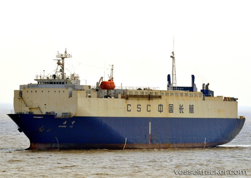
 YENISEY
Current Status
Where is the vessel?
YENISEY is currently in Near Vladivostok, based on AIS data received about 1h ago.
Latest AIS update:
Current position: 43.10408° N, 131.88850° E (Near Vladivostok)
Average speed (last 7 days): Loading…
Average speed (last 30 days): Loading…
Vessel profile: YENISEY is a Vehicles Carrier with dimensions 110m x 21m.
This page combines live AIS, route history, probable destination signals, nearby traffic, and port activity for practical vessel monitoring.
The current position of vessel YENISEY is 43.10408 lat / 131.88850 lng. Updated: 2026-04-15 20:20:33 UTCNearest reference points:
- Near Vostokmorservice
- Near Vladivostok
- Near Dalzavod
Currently sailing under the flag of Sierra Leone ![]()
YENISEY built in 1990 year
Deadweight:
5228 tDetails:
Live Vessel YENISEY Analytics (details, animations, etc.)
Recent AIS points (UTC):
2026-04-15 13:41:31 UTC · 43.10413, 131.88844 · SOG 0 kn · COG 48°2026-04-15 16:17:35 UTC · 43.10410, 131.88849 · SOG 0 kn · COG 48°
2026-04-15 18:05:33 UTC · 43.10413, 131.88844 · SOG 0 kn · COG 48°
2026-04-15 20:20:33 UTC · 43.10408, 131.88850 · SOG 0 kn · COG 48°