 vesseltracker.com
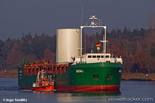
Vessel Natali IMO: 8203543, MMSI: 671978000 General Cargo Ship
UTC, 38.35018, 24.87547, course: 212, speed: 7.2
UTC, 38.23568, 24.80548, course: 211, speed: 7.7
2026-01-18 17:41:44 UTC, 37.98598, 24.63170, course: 210, speed: 7.4
Live AIS position:
UTC. Near Gávrion),
updated 2026-01-18 17:41:44 UTC.
Find the position of the vessel Natali on the map. The latter are known coordinates and path.
marine traffic ship tracker show on live map
The current position of vessel Natali is 37.98598 lat / 24.63170 lng. Updated: 2026-01-18 17:41:44 UTCCurrently sailing under the flag of Togo
Natali built in 1983 year
Deadweight:
2352 tDetails:
Last coordinates of the vessel:
UTC, 38.43828, 24.93237, course: 211, speed: 7.2UTC, 38.35018, 24.87547, course: 212, speed: 7.2
UTC, 38.23568, 24.80548, course: 211, speed: 7.7
2026-01-18 17:41:44 UTC, 37.98598, 24.63170, course: 210, speed: 7.4