 vesseltracker.com
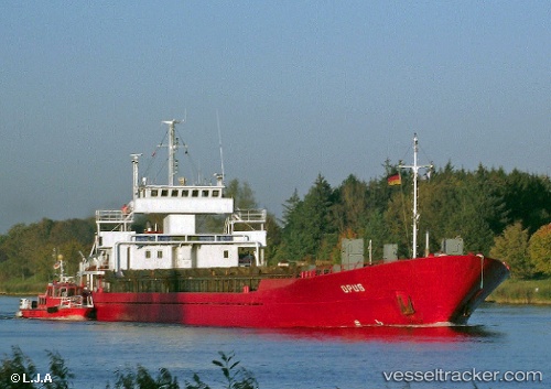
Vessel Sibel J IMO: 7900091, MMSI: 677017000 Multi Purpose Carrier
UTC, 34.90460, 35.86526, course: -1, speed: 0
UTC, 34.90460, 35.86525, course: -1, speed: 0
2026-02-14 01:46:40 UTC, 34.90460, 35.86525, course: -1, speed: 0
Live AIS position:
UTC. Near Tartous),
updated 2026-02-14 01:46:40 UTC.
Find the position of the vessel Sibel J on the map. The latter are known coordinates and path.
marine traffic ship tracker show on live map
The current position of vessel Sibel J is 34.90460 lat / 35.86525 lng. Updated: 2026-02-14 01:46:40 UTCCurrently sailing under the flag of Tanzania
Sibel J built in 1979 year
Deadweight:
2507 tDetails:
Last coordinates of the vessel:
UTC, 34.90463, 35.86525, course: -1, speed: 0UTC, 34.90460, 35.86526, course: -1, speed: 0
UTC, 34.90460, 35.86525, course: -1, speed: 0
2026-02-14 01:46:40 UTC, 34.90460, 35.86525, course: -1, speed: 0