 vesseltracker.com
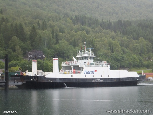
 Goma
Goma
Current Status
Where is the vessel?
Goma is currently in Near Langøya, based on AIS data received about 1h ago.
Latest AIS update:
Current position: 59.49225° N, 10.38001° E (Near Langøya)
Average speed (last 7 days): Loading…
Average speed (last 30 days): Loading…
Vessel profile: Goma is a Passenger Ro Ro Cargo Ship with dimensions 50m x 10m.
This page combines live AIS, route history, probable destination signals, nearby traffic, and port activity for practical vessel monitoring.
The current position of vessel Goma is 59.49225 lat / 10.38001 lng. Updated: 2026-03-29 06:09:39 UTCNearest reference points:
- Near Langøya
- Near Husøy - Tønsberg
- Near Slemmestad
Currently sailing under the flag of Norway ![]()
Goma built in 1968 year
Details:
Live Vessel Goma Analytics (details, animations, etc.)
Recent AIS points (UTC):
2026-03-29 00:15:36 UTC · 59.49227, 10.38002 · SOG 0 kn · COG 312°2026-03-29 01:21:45 UTC · 59.49225, 10.38003 · SOG 0 kn · COG 313°
2026-03-29 04:17:44 UTC · 59.49227, 10.38002 · SOG 0 kn · COG 313°
2026-03-29 06:09:39 UTC · 59.49225, 10.38001 · SOG 0 kn · COG 312°