 vesseltracker.com
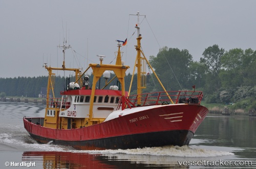
 MARY ANN
Current Status
Where is the vessel?
MARY ANN is currently in 16 nm NW of de Ruyter, based on AIS data received about 3h ago.
Latest AIS update:
Current position: 52.46782° N, 3.71360° E (16 nm NW of de Ruyter)
Average speed (last 7 days): Loading…
Average speed (last 30 days): Loading…
Vessel profile: MARY ANN is a Standby Safety Vessel with dimensions m x m.
This page combines live AIS, route history, probable destination signals, nearby traffic, and port activity for practical vessel monitoring.
The current position of vessel MARY ANN is 52.46782 lat / 3.71360 lng. Updated: 2026-03-26 09:45:42 UTCNearest reference points:
- 23 nm N of de Ruyter
- Near de Ruyter
- 22 nm W of Schoorl
Currently sailing under the flag of San Marino ![]()
Details:
Live Vessel MARY ANN Analytics (details, animations, etc.)
Recent AIS points (UTC):
2026-03-26 04:02:49 UTC · 52.45887, 4.59141 · SOG 0 kn · COG 302°2026-03-26 06:23:22 UTC · 52.49641, 4.37750 · SOG 9.7 kn · COG 281°
2026-03-26 07:25:43 UTC · 52.51969, 4.11743 · SOG 9.2 kn · COG 266°
2026-03-26 09:45:42 UTC · 52.46782, 3.71360 · SOG 6.9 kn · COG 252°