 vesseltracker.com
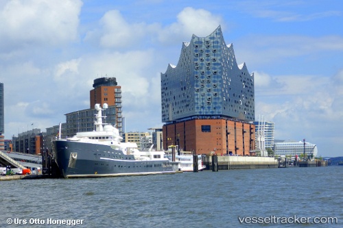
 AQUA LARES
Current Status
Where is the vessel?
AQUA LARES is currently in 12 nm W of Ile Desroches, based on AIS data received about 2h ago.
Latest AIS update:
Current position: 5.74167° S, 53.48833° E (12 nm W of Ile Desroches)
Average speed (last 7 days): Loading…
Average speed (last 30 days): Loading…
Vessel profile: AQUA LARES is a Yacht with dimensions m x m.
This page combines live AIS, route history, probable destination signals, nearby traffic, and port activity for practical vessel monitoring.
The current position of vessel AQUA LARES is -5.74167 lat / 53.48833 lng. Updated: 2026-03-29 00:55:51 UTCNearest reference points:
- Near Ile Desroches
- 118 nm W of Ile Desroches
- 130 nm S of Ile Desroches
Currently sailing under the flag of Marshall Islands ![]()
Details:
Live Vessel AQUA LARES Analytics (details, animations, etc.)
Recent AIS points (UTC):
2026-03-28 20:05:04 UTC · -6.48067, 53.08829 · SOG 10.5 kn · COG 20°2026-03-28 22:08:52 UTC · -6.16070, 53.25795 · SOG 10.1 kn · COG 28°
2026-03-28 23:43:51 UTC · -5.92167, 53.39167 · SOG 10 kn · COG -1°
2026-03-29 00:55:51 UTC · -5.74167, 53.48833 · SOG 10 kn · COG -1°