 vesseltracker.com
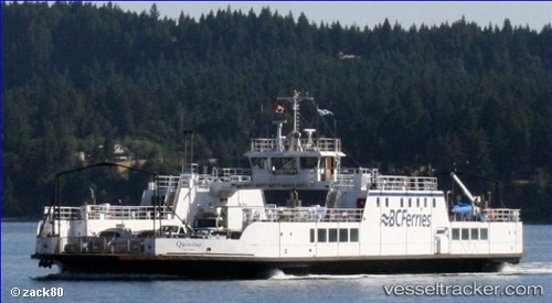
 Quinitsa
Current Status
Where is the vessel?
Quinitsa is currently in Near Fanny Bay, based on AIS data received about 2h ago.
Latest AIS update:
Current position: 49.52696° N, 124.84764° W (Near Fanny Bay)
Average speed (last 7 days): Loading…
Average speed (last 30 days): Loading…
Vessel profile: Quinitsa is a Passenger Ro Ro Cargo Ship with dimensions 54m x 54m.
This page combines live AIS, route history, probable destination signals, nearby traffic, and port activity for practical vessel monitoring.
The current position of vessel Quinitsa is 49.52696 lat / -124.84764 lng. Updated: 2026-03-26 10:13:22 UTCNearest reference points:
- Near Powell River
- 21 nm NW of Tatoosh Island
- Near Nanaimo
Currently sailing under the flag of Canada ![]()
Details:
Live Vessel Quinitsa Analytics (details, animations, etc.)
Recent AIS points (UTC):
2026-03-26 03:44:29 UTC · 49.53518, -124.82440 · SOG 1.5 kn · COG 306°2026-03-26 06:19:19 UTC · 49.52695, -124.84766 · SOG 0 kn · COG 341°
2026-03-26 07:25:28 UTC · 49.52667, -124.84833 · SOG 0 kn · COG -1°
2026-03-26 10:13:22 UTC · 49.52696, -124.84764 · SOG 0 kn · COG 342°