 vesseltracker.com
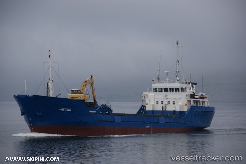
 Hav Tind
Current Status
Where is the vessel?
Hav Tind is currently in Near Skáli, based on AIS data received about 1h ago.
Latest AIS update:
Current position: 62.19590° N, 6.73853° W (Near Skáli)
Average speed (last 7 days): Loading…
Average speed (last 30 days): Loading…
Vessel profile: Hav Tind is a General Cargo Ship with dimensions 60m x 11m.
This page combines live AIS, route history, probable destination signals, nearby traffic, and port activity for practical vessel monitoring.
The current position of vessel Hav Tind is 62.19590 lat / -6.73853 lng. Updated: 2026-03-29 21:38:10 UTCNearest reference points:
- Near FUGLAFJORDUR
- Near VESTMANNA
- 20 nm S of Vágur
Currently sailing under the flag of Faroe Is ![]()
Hav Tind built in 1980 year
Deadweight:
1315 tDetails:
Live Vessel Hav Tind Analytics (details, animations, etc.)
Recent AIS points (UTC):
2026-03-29 15:39:04 UTC · 62.19588, -6.73850 · SOG 0.1 kn · COG 296°2026-03-29 17:23:03 UTC · 62.19593, -6.73851 · SOG 0.1 kn · COG 297°
2026-03-29 19:30:04 UTC · 62.19594, -6.73847 · SOG 0.1 kn · COG 297°
2026-03-29 21:38:10 UTC · 62.19590, -6.73853 · SOG 0 kn · COG 296°