 vesseltracker.com
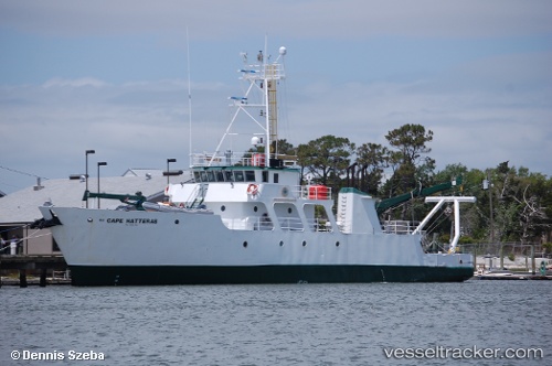
 CAPE HATTERAS
Current Status
Where is the vessel?
CAPE HATTERAS is currently in Near Oak Island, based on AIS data received about 1h ago.
Latest AIS update:
Current position: 33.87999° N, 78.14047° W (Near Oak Island)
Average speed (last 7 days): Loading…
Average speed (last 30 days): Loading…
Vessel profile: CAPE HATTERAS is a Research/Survey Vessel with dimensions m x m.
This page combines live AIS, route history, probable destination signals, nearby traffic, and port activity for practical vessel monitoring.
The current position of vessel CAPE HATTERAS is 33.87999 lat / -78.14047 lng. Updated: 2026-04-08 13:49:56 UTCNearest reference points:
- Near North Myrtle Beach
- Near Morehead City
- Near BEAUFORT
Currently sailing under the flag of United States ![]()
Details:
Live Vessel CAPE HATTERAS Analytics (details, animations, etc.)
Recent AIS points (UTC):
2026-04-08 08:18:45 UTC · 33.86907, -78.10318 · SOG 3.6 kn · COG 9°2026-04-08 10:29:16 UTC · 33.87287, -78.12633 · SOG 3.4 kn · COG 99°
2026-04-08 12:25:32 UTC · 33.88372, -78.13842 · SOG 0.5 kn · COG 150°
2026-04-08 13:49:56 UTC · 33.87999, -78.14047 · SOG 0.8 kn · COG 179°