 vesseltracker.com
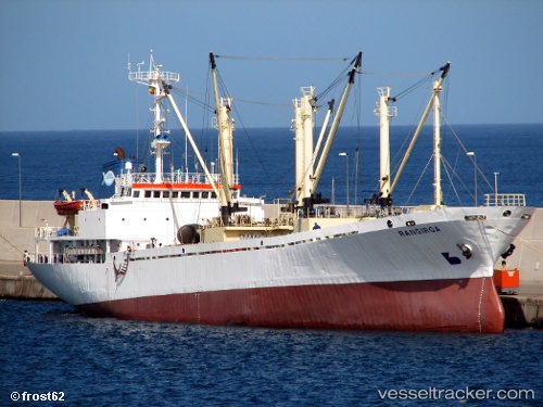
Rangiroa
Current StatusWhere is the vessel?
Rangiroa is currently in 88 nm SW of Bubaque, based on AIS data received less than 1h ago.
Latest AIS update:
Current position: 10.37772° N, 17.00509° W (88 nm SW of Bubaque)
Average speed (last 7 days): Loading…
Average speed (last 30 days): Loading…
Vessel profile: Rangiroa is a Fish Carrier with dimensions 16m x 92m.
This page combines live AIS, route history, probable destination signals, nearby traffic, and port activity for practical vessel monitoring.
The current position of vessel Rangiroa is 10.37772 lat / -17.00509 lng. Updated: 2026-04-04 01:43:35 UTCNearest reference points:
- 144 nm SW of Bubaque
- 97 nm SW of Port de Boké
- 48 nm W of Cap Skiring
Details:
Live Vessel Rangiroa Analytics (details, animations, etc.)
Recent AIS points (UTC):
2026-04-03 20:39:42 UTC · 11.25445, -17.30127 · SOG 10.7 kn · COG 161°2026-04-03 21:36:14 UTC · 11.09515, -17.24979 · SOG 10.7 kn · COG 161°
2026-04-03 23:42:41 UTC · 10.73175, -17.12524 · SOG 10.9 kn · COG 164°
2026-04-04 01:43:35 UTC · 10.37772, -17.00509 · SOG 10.7 kn · COG 154°