 vesseltracker.com
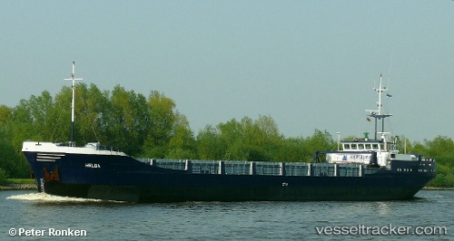
Helga
Current StatusWhere is the vessel?
Helga is currently in Near Nyslott (Savonlinna), based on AIS data received less than 1h ago.
Latest AIS update:
Current position: 61.84399° N, 28.94486° E (Near Nyslott (Savonlinna))
Average speed (last 7 days): Loading…
Average speed (last 30 days): Loading…
Vessel profile: Helga is a General Cargo Ship with dimensions 11m x 80m.
This page combines live AIS, route history, probable destination signals, nearby traffic, and port activity for practical vessel monitoring.
The current position of vessel Helga is 61.84399 lat / 28.94486 lng. Updated: 2026-04-03 12:00:58 UTCNearest reference points:
- Near Primorsk
- 10 nm SE of Primorsk
- 14 nm NW of KRONSHTADT
Details:
Live Vessel Helga Analytics (details, animations, etc.)
Recent AIS points (UTC):
2026-04-03 06:12:53 UTC · 61.84397, 28.94486 · SOG 0 kn · COG 94°2026-04-03 08:12:58 UTC · 61.84398, 28.94484 · SOG 0 kn · COG 94°
2026-04-03 10:15:58 UTC · 61.84396, 28.94488 · SOG 0 kn · COG 94°
2026-04-03 12:00:58 UTC · 61.84399, 28.94486 · SOG 0 kn · COG 94°