 vesseltracker.com
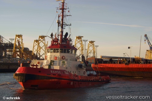
 SVEND
SVEND
Current Status
Where is the vessel?
SVEND is currently in Near Ecklak, based on AIS data received about 1h ago.
Latest AIS update:
Current position: 53.96093° N, 9.24921° E (Near Ecklak)
Average speed (last 7 days): Loading…
Average speed (last 30 days): Loading…
Vessel profile: SVEND is a Tug with dimensions m x m.
This page combines live AIS, route history, probable destination signals, nearby traffic, and port activity for practical vessel monitoring.
The current position of vessel SVEND is 53.96093 lat / 9.24921 lng. Updated: 2026-03-28 05:24:08 UTCNearest reference points:
- Near Kiel Canal
- Near Abbenfleth
- Near Stader Sand
Currently sailing under the flag of Denmark ![]()
Details:
Live Vessel SVEND Analytics (details, animations, etc.)
Recent AIS points (UTC):
2026-03-27 23:34:58 UTC · 54.35531, 9.88514 · SOG 7 kn · COG 299°2026-03-28 02:05:28 UTC · 54.23056, 9.60447 · SOG 6.9 kn · COG 200°
2026-03-28 03:38:39 UTC · 54.14360, 9.34778 · SOG 6.5 kn · COG 228°
2026-03-28 05:24:08 UTC · 53.96093, 9.24921 · SOG 6.7 kn · COG 217°