 vesseltracker.com
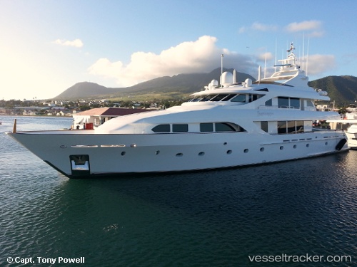
 FORTITUDE
Current Status
Where is the vessel?
FORTITUDE is currently in Near CULEBRA, based on AIS data received about 1h ago.
Latest AIS update:
Current position: 18.29726° N, 65.28058° W (Near CULEBRA)
Average speed (last 7 days): Loading…
Average speed (last 30 days): Loading…
Vessel profile: FORTITUDE is a Yacht with dimensions m x m.
This page combines live AIS, route history, probable destination signals, nearby traffic, and port activity for practical vessel monitoring.
The current position of vessel FORTITUDE is 18.29726 lat / -65.28058 lng. Updated: 2026-03-29 09:42:39 UTCNearest reference points:
- Near Charlotte Amalie
- Near Roosevelt Roads
- Near ST THOMAS
Currently sailing under the flag of Cayman Islands ![]()
Details:
Live Vessel FORTITUDE Analytics (details, animations, etc.)
Recent AIS points (UTC):
2026-03-29 03:51:40 UTC · 18.29739, -65.28068 · SOG 0 kn · COG -1°2026-03-29 05:55:41 UTC · 18.29727, -65.28064 · SOG 0 kn · COG -1°
2026-03-29 07:45:40 UTC · 18.29740, -65.28071 · SOG 0 kn · COG -1°
2026-03-29 09:42:39 UTC · 18.29726, -65.28058 · SOG 0 kn · COG -1°