 vesseltracker.com
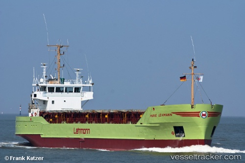
 Marie b
Current Status
Where is the vessel?
Marie b is currently in Near IJMOND, based on AIS data received about 1h ago.
Latest AIS update:
Current position: 52.43748° N, 4.70927° E (Near IJMOND)
Average speed (last 7 days): Loading…
Average speed (last 30 days): Loading…
Vessel profile: Marie b is a General Cargo Ship with dimensions 80m x 13m.
This page combines live AIS, route history, probable destination signals, nearby traffic, and port activity for practical vessel monitoring.
The current position of vessel Marie b is 52.43748 lat / 4.70927 lng. Updated: 2026-03-28 15:45:24 UTCNearest reference points:
- Near NAUERNA
- Near BEVERWIJK
- Near Lijnden
Currently sailing under the flag of Antigua Barbuda ![]()
Marie b built in 1987 year
Deadweight:
3017 tDetails:
Live Vessel Marie b Analytics (details, animations, etc.)
Recent AIS points (UTC):
2026-03-28 09:37:33 UTC · 52.40182, 4.86860 · SOG 0 kn · COG 53°2026-03-28 12:31:32 UTC · 52.40183, 4.86830 · SOG 0 kn · COG 53°
2026-03-28 14:01:33 UTC · 52.40170, 4.86812 · SOG 0 kn · COG 53°
2026-03-28 15:45:24 UTC · 52.43748, 4.70927 · SOG 9 kn · COG 306°