 vesseltracker.com
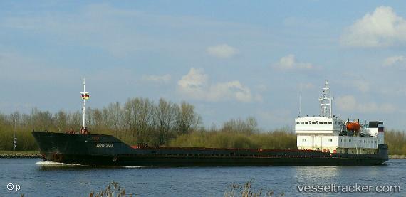
Kasma
Current StatusWhere is the vessel?
Kasma is currently in Near Aktau, based on AIS data received about 1h ago.
Latest AIS update:
Current position: 43.55557° N, 51.19560° E (Near Aktau)
Average speed (last 7 days): Loading…
Average speed (last 30 days): Loading…
Vessel profile: Kasma is a Multi Purpose Carrier with dimensions 13m x 116m.
This page combines live AIS, route history, probable destination signals, nearby traffic, and port activity for practical vessel monitoring.
The current position of vessel Kasma is 43.55557 lat / 51.19560 lng. Updated: 2026-03-30 01:25:39 UTCNearest reference points:
- 12 nm S of Aktau
- 24 nm W of Kuryk
- 35 nm W of Kuryk
Details:
Live Vessel Kasma Analytics (details, animations, etc.)
Recent AIS points (UTC):
2026-03-29 19:22:37 UTC · 43.55584, 51.19606 · SOG 0 kn · COG 155°2026-03-29 21:43:32 UTC · 43.55577, 51.19619 · SOG 0 kn · COG 157°
2026-03-29 23:19:26 UTC · 43.55581, 51.19625 · SOG 0 kn · COG 160°
2026-03-30 01:25:39 UTC · 43.55557, 51.19560 · SOG 0 kn · COG 125°