 vesseltracker.com
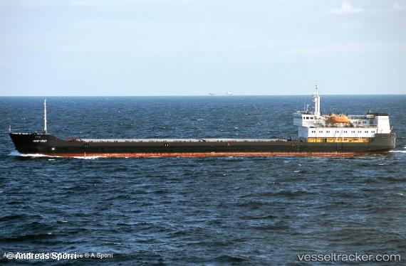
 ATLANTIS
Current Status
Where is the vessel?
ATLANTIS is currently in Near TEKIRDAG, based on AIS data received about 18h ago.
Latest AIS update:
Current position: 40.94513° N, 27.54438° E (Near TEKIRDAG)
Average speed (last 7 days): Loading…
Average speed (last 30 days): Loading…
Vessel profile: ATLANTIS is a General Cargo with dimensions m x m.
This page combines live AIS, route history, probable destination signals, nearby traffic, and port activity for practical vessel monitoring.
The current position of vessel ATLANTIS is 40.94513 lat / 27.54438 lng. Updated: 2026-04-10 07:23:13 UTCNearest reference points:
- Near TEKIRDAG
- Near Saraylar
- Near Sarköy
Currently sailing under the flag of Comoros ![]()
Details:
Live Vessel ATLANTIS Analytics (details, animations, etc.)
Recent AIS points (UTC):
2026-04-10 02:13:33 UTC · 40.94420, 27.54551 · SOG 0.1 kn · COG 2°2026-04-10 04:01:57 UTC · 40.94414, 27.54517 · SOG 0 kn · COG 14°
2026-04-10 05:33:05 UTC · 40.94423, 27.54560 · SOG 0 kn · COG 355°
2026-04-10 07:23:13 UTC · 40.94513, 27.54438 · SOG 0.1 kn · COG 92°