 vesseltracker.com
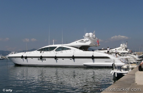
 PLAN A
Current Status
Where is the vessel?
PLAN A is currently in Near PALMA DE MALLORCA, based on AIS data received about 8d ago.
Latest AIS update:
Current position: 39.56477° N, 2.64019° E (Near PALMA DE MALLORCA)
Average speed (last 7 days): Loading…
Average speed (last 30 days): Loading…
Vessel profile: PLAN A is a Houseboat with dimensions 8m x 40m.
This page combines live AIS, route history, probable destination signals, nearby traffic, and port activity for practical vessel monitoring.
The current position of vessel PLAN A is 39.56477 lat / 2.64019 lng. Updated: 2026-03-22 16:32:40 UTCNearest reference points:
- Near PALMA DE MALLORCA
- Near Palma
- Near PORTALS NOUS
Currently sailing under the flag of Malta ![]()
PLAN A built in 2007 year
Deadweight:
0 tDetails:
Live Vessel PLAN A Analytics (details, animations, etc.)
Recent AIS points (UTC):
2026-03-22 15:57:23 UTC · 39.56480, 2.64017 · SOG 0 kn · COG 318°2026-03-22 16:32:40 UTC · 39.56477, 2.64019 · SOG 0 kn · COG -1°
2026-03-22 16:32:40 UTC · 39.56477, 2.64019 · SOG 0 kn · COG -1°
2026-03-22 16:32:40 UTC · 39.56477, 2.64019 · SOG 0 kn · COG -1°