 vesseltracker.com
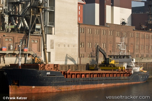
 HAVBRIS
Current Status
Where is the vessel?
HAVBRIS is currently in 21 nm NW of Hirtshals, based on AIS data received about 3h ago.
Latest AIS update:
Current position: 57.88768° N, 9.58660° E (21 nm NW of Hirtshals)
Average speed (last 7 days): Loading…
Average speed (last 30 days): Loading…
Vessel profile: HAVBRIS is a General Cargo with dimensions m x m.
This page combines live AIS, route history, probable destination signals, nearby traffic, and port activity for practical vessel monitoring.
The current position of vessel HAVBRIS is 57.88768 lat / 9.58660 lng. Updated: 2026-03-28 07:24:23 UTCNearest reference points:
- 15 nm N of Hirtshals
- Near Hirtshals
- 28 nm NW of Lokken
Currently sailing under the flag of Norway ![]()
Details:
Live Vessel HAVBRIS Analytics (details, animations, etc.)
Recent AIS points (UTC):
2026-03-28 02:05:23 UTC · 57.81372, 10.90355 · SOG 7.8 kn · COG 298°2026-03-28 03:38:43 UTC · 57.85161, 10.54179 · SOG 8 kn · COG 273°
2026-03-28 05:24:03 UTC · 57.86296, 10.10218 · SOG 8 kn · COG 277°
2026-03-28 07:24:23 UTC · 57.88768, 9.58660 · SOG 8.1 kn · COG 274°