 vesseltracker.com
 MANUELA S
Current Status
Where is the vessel?
MANUELA S is currently in 13 nm SE of Idestrup, based on AIS data received less than 1h ago.
Latest AIS update:
Current position: 54.63918° N, 12.31827° E (13 nm SE of Idestrup)
Average speed (last 7 days): Loading…
Average speed (last 30 days): Loading…
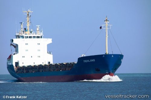
Vessel profile: MANUELA S is a General Cargo Ship with dimensions 105m x 16m.
This page combines live AIS, route history, probable destination signals, nearby traffic, and port activity for practical vessel monitoring.
The current position of vessel MANUELA S is 54.63918 lat / 12.31827 lng. Updated: 2026-03-30 05:24:23 UTCNearest reference points:
- 10 nm NW of Graal-Müritz
- Near Pruchten
- Near Warnemunde
Currently sailing under the flag of Cyprus ![]()
MANUELA S built in 1989 year
Deadweight:
4402 tDetails:
Live Vessel MANUELA S Analytics (details, animations, etc.)
Recent AIS points (UTC):
2026-03-29 23:49:03 UTC · 55.01055, 13.77616 · SOG 10.5 kn · COG 249°2026-03-30 01:41:54 UTC · 54.90242, 13.23183 · SOG 10.3 kn · COG 250°
2026-03-30 03:44:14 UTC · 54.78987, 12.68933 · SOG 8.6 kn · COG 234°
2026-03-30 05:24:23 UTC · 54.63918, 12.31827 · SOG 9 kn · COG 238°