 vesseltracker.com
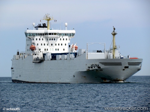
 PEACELAND
Current Status
Where is the vessel?
PEACELAND is currently in 16 nm E of Soroosh (Cyrus) Terminal, based on AIS data received about 2h ago.
Latest AIS update:
Current position: 28.93658° N, 49.75134° E (16 nm E of Soroosh (Cyrus) Terminal)
Average speed (last 7 days): Loading…
Average speed (last 30 days): Loading…
Vessel profile: PEACELAND is a Ro-Ro Cargo with dimensions m x m.
This page combines live AIS, route history, probable destination signals, nearby traffic, and port activity for practical vessel monitoring.
The current position of vessel PEACELAND is 28.93658 lat / 49.75134 lng. Updated: 2026-04-02 01:21:56 UTCNearest reference points:
- 31 nm S of Soroosh (Cyrus) Terminal
- 38 nm S of Soroosh (Cyrus) Terminal
- 41 nm S of Soroosh (Cyrus) Terminal
Currently sailing under the flag of Saint Kitts and Nevis ![]()
Details:
Live Vessel PEACELAND Analytics (details, animations, etc.)
Recent AIS points (UTC):
2026-04-01 19:46:52 UTC · 29.54242, 48.88908 · SOG 9.8 kn · COG 139°2026-04-01 21:49:50 UTC · 29.35048, 49.22382 · SOG 10.6 kn · COG -1°
2026-04-01 23:49:35 UTC · 29.14181, 49.55191 · SOG 10.6 kn · COG 130°
2026-04-02 01:21:56 UTC · 28.93658, 49.75134 · SOG 10.4 kn · COG -1°