 vesseltracker.com
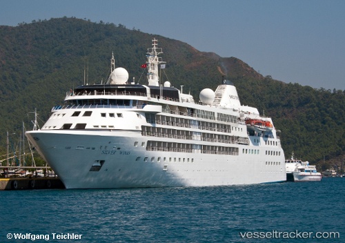
 Silver Wind
Current Status
Where is the vessel?
Silver Wind is currently in 37 nm W of Henties Bay (Hentiesbaai), based on AIS data received about 2h ago.
Latest AIS update:
Current position: 22.05541° S, 13.62527° E (37 nm W of Henties Bay (Hentiesbaai))
Average speed (last 7 days): Loading…
Average speed (last 30 days): Loading…
Vessel profile: Silver Wind is a Cruise Ship with dimensions 156m x 21m.
This page combines live AIS, route history, probable destination signals, nearby traffic, and port activity for practical vessel monitoring.
The current position of vessel Silver Wind is -22.05541 lat / 13.62527 lng. Updated: 2026-04-07 01:28:59 UTCNearest reference points:
- Near WALVIS BAY
- 151 nm W of Henties Bay (Hentiesbaai)
- 161 nm W of Walvisbaai
Currently sailing under the flag of Bahamas ![]()
Silver Wind built in 1995 year
Deadweight:
1790 tDetails:
Live Vessel Silver Wind Analytics (details, animations, etc.)
Recent AIS points (UTC):
2026-04-06 19:41:35 UTC · -22.95500, 14.48833 · SOG 0 kn · COG -1°2026-04-06 21:48:23 UTC · -22.67359, 14.31926 · SOG 13.8 kn · COG 311°
2026-04-06 23:30:10 UTC · -22.39500, 13.99333 · SOG 14 kn · COG -1°
2026-04-07 01:28:59 UTC · -22.05541, 13.62527 · SOG 14.1 kn · COG 324°