 vesseltracker.com
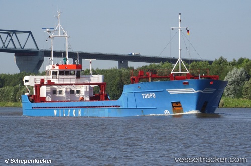
 Torpo
Torpo
Current Status
Where is the vessel?
Torpo is currently in Near Kamaterón, based on AIS data received about 3h ago.
Latest AIS update:
Current position: 37.94676° N, 23.54515° E (Near Kamaterón)
Average speed (last 7 days): Loading…
Average speed (last 30 days): Loading…
Vessel profile: Torpo is a General Cargo Ship with dimensions 88m x 14m.
This page combines live AIS, route history, probable destination signals, nearby traffic, and port activity for practical vessel monitoring.
The current position of vessel Torpo is 37.94676 lat / 23.54515 lng. Updated: 2026-03-28 07:21:07 UTCNearest reference points:
- Near PERAMA
- Near Drapetzona
- Near Keratsínion
Currently sailing under the flag of Barbados ![]()
Torpo built in 1990 year
Deadweight:
3504 tDetails:
Live Vessel Torpo Analytics (details, animations, etc.)
Recent AIS points (UTC):
2026-03-28 01:21:08 UTC · 37.94687, 23.54514 · SOG 0 kn · COG 359°2026-03-28 03:57:08 UTC · 37.94687, 23.54515 · SOG 0 kn · COG 359°
2026-03-28 06:24:08 UTC · 37.94688, 23.54513 · SOG 0 kn · COG 359°
2026-03-28 07:21:07 UTC · 37.94676, 23.54515 · SOG 0 kn · COG 359°