 vesseltracker.com
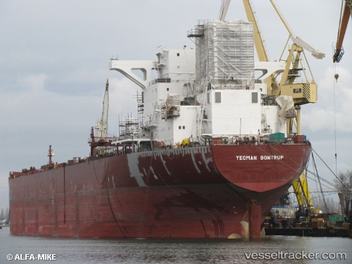
 Yeoman Bontrup
Current Status
Where is the vessel?
Yeoman Bontrup is currently in 63 nm NW of Town Quays/Drogheda, based on AIS data received about 2h ago.
Latest AIS update:
Current position: 54.43665° N, 5.03952° E (63 nm NW of Town Quays/Drogheda)
Average speed (last 7 days): Loading…
Average speed (last 30 days): Loading…
Vessel profile: Yeoman Bontrup is a Self Discharging Bulk Carrier with dimensions 250m x 38m.
This page combines live AIS, route history, probable destination signals, nearby traffic, and port activity for practical vessel monitoring.
The current position of vessel Yeoman Bontrup is 54.43665 lat / 5.03952 lng. Updated: 2026-03-26 17:31:37 UTCNearest reference points:
- 14 nm NW of Town Quays/Drogheda
- Near HARLINGEN
- Near FRANEKER
Currently sailing under the flag of Bahamas ![]()
Yeoman Bontrup built in 1991 year
Deadweight:
96725 tDetails:
Live Vessel Yeoman Bontrup Analytics (details, animations, etc.)
Recent AIS points (UTC):
2026-03-26 12:22:57 UTC · 53.94788, 5.02226 · SOG 6.5 kn · COG 8°2026-03-26 13:52:40 UTC · 54.07588, 5.10352 · SOG 6.1 kn · COG -1°
2026-03-26 15:38:49 UTC · 54.23393, 5.14994 · SOG 5 kn · COG -1°
2026-03-26 17:31:37 UTC · 54.43665, 5.03952 · SOG 6.1 kn · COG 352°