 vesseltracker.com
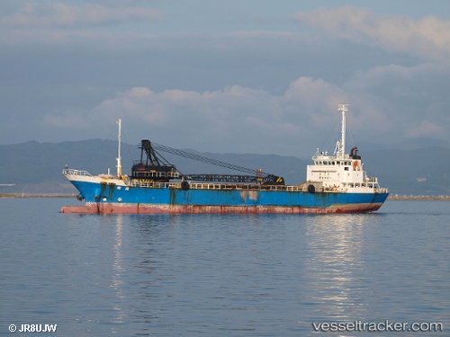
 ILDA
ILDA
Current Status
Where is the vessel?
ILDA is currently in 10 nm SE of LENGEH, based on AIS data received about 1d ago.
Latest AIS update:
Current position: 26.43001° N, 55.02086° E (10 nm SE of LENGEH)
Average speed (last 7 days): Loading…
Average speed (last 30 days): Loading…
Vessel profile: ILDA is a Cargo with dimensions m x m.
This page combines live AIS, route history, probable destination signals, nearby traffic, and port activity for practical vessel monitoring.
The current position of vessel ILDA is 26.43001 lat / 55.02086 lng. Updated: 2026-04-10 06:42:05 UTCNearest reference points:
- Near LENGEH
- 20 nm NW of Hulaylah Terminal
- 13 nm NW of Hulaylah Terminal
Currently sailing under the flag of Comoros ![]()
Details:
Live Vessel ILDA Analytics (details, animations, etc.)
Recent AIS points (UTC):
2026-04-10 02:17:04 UTC · 26.49885, 54.35519 · SOG 7.5 kn · COG 111°2026-04-10 03:48:22 UTC · 26.46888, 54.56865 · SOG 7.9 kn · COG -1°
2026-04-10 03:48:22 UTC · 26.46888, 54.56865 · SOG 7.9 kn · COG -1°
2026-04-10 06:42:05 UTC · 26.43001, 55.02086 · SOG 8.7 kn · COG 93°