 vesseltracker.com
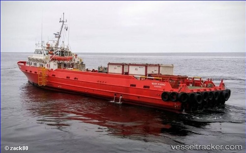
 Mare Rubino
Current Status
Where is the vessel?
Mare Rubino is currently in 29 nm NW of Pointe Noire, based on AIS data received less than 1h ago.
Latest AIS update:
Current position: 4.59636° S, 11.39291° E (29 nm NW of Pointe Noire)
Average speed (last 7 days): Loading…
Average speed (last 30 days): Loading…
Vessel profile: Mare Rubino is a Offshore Tug Supply Ship with dimensions 56m x 8m.
This page combines live AIS, route history, probable destination signals, nearby traffic, and port activity for practical vessel monitoring.
The current position of vessel Mare Rubino is -4.59636 lat / 11.39291 lng. Updated: 2026-04-23 03:30:26 UTCNearest reference points:
- Near Pointe Noire
- Near N'Kossa Terminal
- Near Futila Terminal
Currently sailing under the flag of Italy ![]()
Details:
Live Vessel Mare Rubino Analytics (details, animations, etc.)
Recent AIS points (UTC):
2026-04-22 22:01:52 UTC · -4.62028, 11.46629 · SOG 17 kn · COG 288°2026-04-23 00:12:54 UTC · -4.41456, 11.03627 · SOG 0.7 kn · COG 297°
2026-04-23 01:10:30 UTC · -4.41333, 11.03500 · SOG 0 kn · COG -1°
2026-04-23 03:30:26 UTC · -4.59636, 11.39291 · SOG 15.3 kn · COG 107°