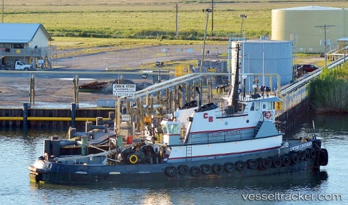
.
Vessel photo of Crosby Crusader (IMO 8964616) vesseltracker.com

US flag Crosby Crusader

Vessel type: Tug | IMO: 8964616 | MMSI: MMSI: 366768480
Call sign: WCZ3649
Current Status

Where is the vessel?

Crosby Crusader is currently in Near HOUMA, based on AIS data received about 1h ago.

Latest AIS update:

Current position: 29.54552° N, 90.70052° W (Near HOUMA)

Average speed (last 7 days): Loading…

Average speed (last 30 days): Loading…

Vessel profile: Crosby Crusader is a Tug with dimensions m x m.

This page combines live AIS, route history, probable destination signals, nearby traffic, and port activity for practical vessel monitoring.

The current position of vessel Crosby Crusader is 29.54552 lat / -90.70052 lng. Updated: 2026-03-27 03:41:00 UTC
Nearest reference points:
  • Near HOUMA
  • Near Amelia
  • Near Good Hope

Currently sailing under the flag of USA US flag

Details:

Live Vessel Crosby Crusader Analytics (details, animations, etc.)


Recent AIS points (UTC):
2026-03-26 21:38:00 UTC · 29.54550, -90.70056 · SOG 0 kn · COG -1°
2026-03-26 23:53:02 UTC · 29.54549, -90.70055 · SOG 0 kn · COG -1°
2026-03-27 01:26:07 UTC · 29.54552, -90.70057 · SOG 0 kn · COG -1°
2026-03-27 03:41:00 UTC · 29.54552, -90.70052 · SOG 0 kn · COG -1°

Track of the vessel in the last 28 days


UTC: --
Start: -- Track timeline (UTC) End: --
Encountered: --


Link to the map:


Find another ship

Crosby_Crusader (366768480) last ports (portcalls and passsages)

Bourg | 2025-09-14 12:11:59
Bourg | 2025-09-08 18:26:46
HOUMA | 2025-09-03 08:54:12
HOUMA | 2025-08-29 16:04:36
HOUMA | 2025-08-25 14:37:28
HOUMA | 2025-08-21 14:35:13
HOUMA | 2025-02-26 07:39:52
HOUMA | 2025-02-22 07:08:31
HOUMA | 2025-02-18 07:04:03
AMELIA | 2025-02-14 23:40:57
OCEAN MARINE | 2025-02-14 23:22:44
HOUMA | 2025-02-14 06:59:10
HOUMA | 2025-02-10 06:44:08
AMELIA | 2025-02-09 04:12:53
OCEAN MARINE | 2025-02-09 02:41:52
HOUMA | 2025-02-06 06:15:52
HOUMA | 2025-02-02 05:42:27
HOUMA | 2025-01-29 05:04:05
FOURCHON | 2025-01-27 11:40:03
AMELIA | 2025-01-26 11:19:47
HOUMA | 2025-01-23 08:22:43
HOUMA | 2025-01-19 07:32:46
OCEAN MARINE | 2025-01-19 04:33:49
AMELIA | 2025-01-19 04:15:47
AMELIA | 2025-01-04 02:52:11
OCEAN MARINE | 2025-01-04 02:25:01
HOUMA | 2024-12-31 10:46:48
HOUMA | 2024-12-27 10:12:07
HOUMA | 2024-12-23 08:59:09
HOUMA | 2024-12-19 08:27:47
OCEAN MARINE | 2024-12-19 03:42:26
AMELIA | 2024-12-19 02:36:02
CAMERON | 2024-12-13 17:29:14
OCEAN MARINE | 2024-12-06 18:07:30
HOUMA | 2024-12-04 23:10:37
HOUMA | 2024-11-30 22:53:44
HOUMA | 2024-11-26 22:22:48
Lake Charles | 2024-11-24 23:24:01
CAMERON | 2024-11-24 19:13:01
SABINE PASS | 2024-11-21 00:21:18
Port Arthur | 2024-11-18 22:30:09
SABINE PASS | 2024-11-17 00:08:21
FOURCHON | 2024-11-09 06:24:47
Mobile | 2024-07-21 22:03:26
Loop Terminal | 2024-06-23 13:10:50
Galveston | 2024-04-08 07:21:17
Matagorda Bay | 2024-04-03 23:29:37
Loop Terminal | 2023-12-29 04:32:47
Loop Terminal | 2023-12-20 08:22:11
Loop Terminal | 2023-11-12 20:23:42
Loop Terminal | 2023-07-18 07:36:19
Brownsville | 2023-02-28 21:06:23
Brownsville | 2023-02-24 20:10:58
Loop Terminal | 2022-12-29 05:49:11
Port Arthur | 2022-02-28 21:25:02
Port Neches | 2022-02-28 18:35:10
Port Neches | 2022-02-28 04:25:00
Port Neches | 2022-02-28 03:10:52
Port Arthur | 2022-02-28 00:55:11
Galveston | 2022-02-27 18:20:03
Texas City | 2022-02-27 18:15:02
Pasadena | 2022-02-27 15:01:09
Pasadena | 2022-02-27 03:15:50
Pasadena | 2022-02-27 00:00:03
Galveston | 2022-02-26 18:40:02
Port Arthur | 2022-02-18 22:10:16
Port Neches | 2022-02-17 21:20:06
Port Neches | 2022-02-17 18:20:08
Port Neches | 2022-02-14 21:05:18
Port Neches | 2022-02-14 06:45:32
Port Neches | 2022-02-14 00:45:58