 vesseltracker.com
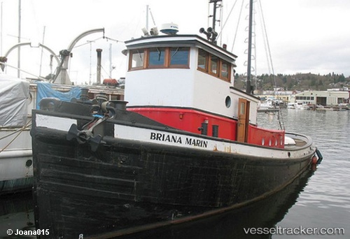
Briana Marie
Current StatusWhere is the vessel?
Briana Marie is currently in 71 nm S of INTRACOASTAL CITY, based on AIS data received about 1h ago.
Latest AIS update:
Current position: 28.60713° N, 92.07433° W (71 nm S of INTRACOASTAL CITY)
Average speed (last 7 days): Loading…
Average speed (last 30 days): Loading…
Vessel profile: Briana Marie is a Offshore Tug Supply Ship with dimensions 10m x 42m.
This page combines live AIS, route history, probable destination signals, nearby traffic, and port activity for practical vessel monitoring.
The current position of vessel Briana Marie is 28.60713 lat / -92.07433 lng. Updated: 2026-04-13 03:37:33 UTCNearest reference points:
- 66 nm NW of Gulfmex Lightering Area
- 83 nm W of Gulfmex Lightering Area
- 97 nm W of Gulfmex Lightering Area
Details:
Live Vessel Briana Marie Analytics (details, animations, etc.)
Recent AIS points (UTC):
2026-04-12 22:11:27 UTC · 28.58500, -92.09333 · SOG 0 kn · COG -1°2026-04-13 00:11:26 UTC · 28.60667, -92.07333 · SOG 0 kn · COG -1°
2026-04-13 02:21:03 UTC · 28.60720, -92.07427 · SOG 0.3 kn · COG -1°
2026-04-13 03:37:33 UTC · 28.60713, -92.07433 · SOG 0.4 kn · COG -1°