 vesseltracker.com
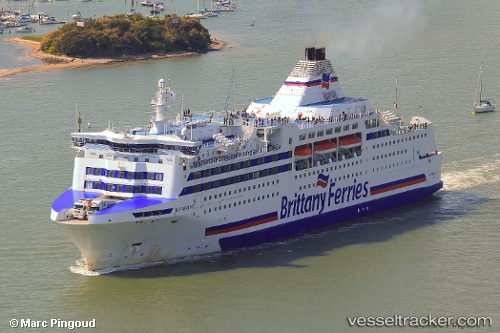
 Normandie
Current Status
Where is the vessel?
Normandie is currently in Near Marseille, based on AIS data received less than 1h ago.
Latest AIS update:
Current position: 43.33865° N, 5.34359° E (Near Marseille)
Average speed (last 7 days): Loading…
Average speed (last 30 days): Loading…
Vessel profile: Normandie is a Passenger Ro Ro Cargo Ship with dimensions 161m x 26m.
This page combines live AIS, route history, probable destination signals, nearby traffic, and port activity for practical vessel monitoring.
The current position of vessel Normandie is 43.33865 lat / 5.34359 lng. Updated: 2026-04-02 03:43:07 UTCNearest reference points:
- Near Marseille
- Near Le Canet
- Near LA CIOTAT
Currently sailing under the flag of France ![]()
Normandie built in 1992 year
Deadweight:
5229 tDetails:
Live Vessel Normandie Analytics (details, animations, etc.)
Recent AIS points (UTC):
2026-04-01 22:07:04 UTC · 43.33865, 5.34358 · SOG 0 kn · COG 329°2026-04-02 00:10:07 UTC · 43.33862, 5.34358 · SOG 0 kn · COG 329°
2026-04-02 02:10:17 UTC · 43.33862, 5.34359 · SOG 0.1 kn · COG 329°
2026-04-02 03:43:07 UTC · 43.33865, 5.34359 · SOG 0 kn · COG 329°