 vesseltracker.com
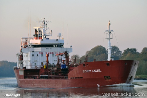
 M/T YIGIT
Current Status
Where is the vessel?
M/T YIGIT is currently in 20 nm SE of OKPO, based on AIS data received about 2h ago.
Latest AIS update:
Current position: 34.70965° N, 129.05412° E (20 nm SE of OKPO)
Average speed (last 7 days): Loading…
Average speed (last 30 days): Loading…
Vessel profile: M/T YIGIT is a Oil/Chemical Tanker with dimensions m x m.
This page combines live AIS, route history, probable destination signals, nearby traffic, and port activity for practical vessel monitoring.
The current position of vessel M/T YIGIT is 34.70965 lat / 129.05412 lng. Updated: 2026-03-26 19:36:02 UTCNearest reference points:
- 20 nm W of HITAKATSU
- 15 nm E of OKPO
- Near OKPO
Currently sailing under the flag of Malta ![]()
Details:
Live Vessel M/T YIGIT Analytics (details, animations, etc.)
Recent AIS points (UTC):
2026-03-26 14:19:17 UTC · 34.95384, 129.33142 · SOG 13.7 kn · COG 221°2026-03-26 16:03:30 UTC · 34.63966, 129.01796 · SOG 13.9 kn · COG 235°
2026-03-26 17:26:38 UTC · 34.68593, 129.05656 · SOG 13.8 kn · COG 40°
2026-03-26 19:36:02 UTC · 34.70965, 129.05412 · SOG 11.2 kn · COG 230°