 vesseltracker.com
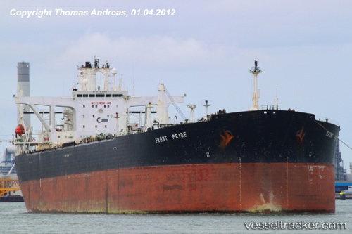
 Magus
Magus
Current Status
Where is the vessel?
Magus is currently in 159 nm S of Offshore Ambrose, based on AIS data received about 1h ago.
Latest AIS update:
Current position: 37.65574° N, 71.06584° W (159 nm S of Offshore Ambrose)
Average speed (last 7 days): Loading…
Average speed (last 30 days): Loading…
Vessel profile: Magus is a Crude Oil Tanker with dimensions 268m x 46m.
This page combines live AIS, route history, probable destination signals, nearby traffic, and port activity for practical vessel monitoring.
The current position of vessel Magus is 37.65574 lat / -71.06584 lng. Updated: 2026-03-29 13:42:26 UTCNearest reference points:
- 187 nm SE of Offshore Ambrose
- 114 nm SE of Offshore Ambrose
- 126 nm SE of Offshore Ambrose
Currently sailing under the flag of Panama ![]()
Magus built in 1993 year
Deadweight:
149686 tDetails:
Live Vessel Magus Analytics (details, animations, etc.)
Recent AIS points (UTC):
2026-03-29 09:31:36 UTC · 37.80143, -69.93151 · SOG 12.9 kn · COG 259°2026-03-29 09:57:35 UTC · 37.78621, -70.04578 · SOG 12.9 kn · COG 263°
2026-03-29 11:16:08 UTC · 37.74485, -70.39917 · SOG 12.9 kn · COG 263°
2026-03-29 13:42:26 UTC · 37.65574, -71.06584 · SOG 13.3 kn · COG 262°