 vesseltracker.com
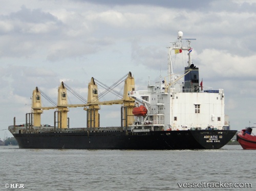
 PRINCESS BANA
Current Status
Where is the vessel?
PRINCESS BANA is currently in 19 nm SW of Melito di Porto Salvo, based on AIS data received about 1h ago.
Latest AIS update:
Current position: 37.62678° N, 15.61322° E (19 nm SW of Melito di Porto Salvo)
Average speed (last 7 days): Loading…
Average speed (last 30 days): Loading…
Vessel profile: PRINCESS BANA is a Bulk Carrier with dimensions 158m x 25m.
This page combines live AIS, route history, probable destination signals, nearby traffic, and port activity for practical vessel monitoring.
The current position of vessel PRINCESS BANA is 37.62678 lat / 15.61322 lng. Updated: 2026-04-02 00:11:05 UTCNearest reference points:
- Near Riposto
- Near San Leo di Pellaro
- Near REGGIO
Currently sailing under the flag of St.Kitts and Nevis ![]()
PRINCESS BANA built in 1994 year
Deadweight:
22059 tDetails:
Live Vessel PRINCESS BANA Analytics (details, animations, etc.)
Recent AIS points (UTC):
2026-04-01 17:32:29 UTC · 37.72605, 15.64077 · SOG 0.5 kn · COG 71°2026-04-01 19:42:30 UTC · 37.62093, 15.69642 · SOG 0.7 kn · COG 183°
2026-04-01 22:05:45 UTC · 37.62682, 15.65367 · SOG 0.8 kn · COG 182°
2026-04-02 00:11:05 UTC · 37.62678, 15.61322 · SOG 0.9 kn · COG 151°