 vesseltracker.com
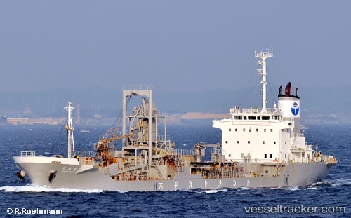
 KAIYA
KAIYA
Current Status
Where is the vessel?
KAIYA is currently in Near WAILINGDING ISLAND, based on AIS data received about 1h ago.
Latest AIS update:
Current position: 22.03795° N, 114.10944° E (Near WAILINGDING ISLAND)
Average speed (last 7 days): Loading…
Average speed (last 30 days): Loading…
Vessel profile: KAIYA is a Cargo with dimensions m x m.
This page combines live AIS, route history, probable destination signals, nearby traffic, and port activity for practical vessel monitoring.
The current position of vessel KAIYA is 22.03795 lat / 114.10944 lng. Updated: 2026-03-30 19:21:18 UTCNearest reference points:
- Near WAILINGDING ISLAND
- Near Pok Fu Lam
- Near Cheung Sha Wan
Currently sailing under the flag of Tuvalu ![]()
Details:
Live Vessel KAIYA Analytics (details, animations, etc.)
Recent AIS points (UTC):
2026-03-30 13:24:16 UTC · 22.03802, 114.10934 · SOG 0 kn · COG 202°2026-03-30 15:51:18 UTC · 22.03766, 114.10969 · SOG 0 kn · COG 230°
2026-03-30 17:48:15 UTC · 22.03785, 114.10957 · SOG 0 kn · COG 218°
2026-03-30 19:21:18 UTC · 22.03795, 114.10944 · SOG 0.1 kn · COG 207°