 vesseltracker.com
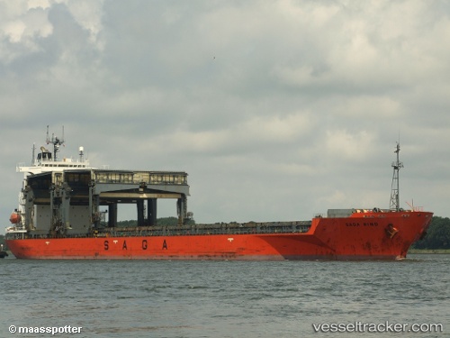
 SAGA WIND
Current Status
Where is the vessel?
SAGA WIND is currently in Near CAPE CANAVERAL, based on AIS data received about 1h ago.
Latest AIS update:
Current position: 28.41115° N, 80.61751° W (Near CAPE CANAVERAL)
Average speed (last 7 days): Loading…
Average speed (last 30 days): Loading…
Vessel profile: SAGA WIND is a General Cargo with dimensions m x m.
This page combines live AIS, route history, probable destination signals, nearby traffic, and port activity for practical vessel monitoring.
The current position of vessel SAGA WIND is 28.41115 lat / -80.61751 lng. Updated: 2026-04-18 17:59:18 UTCNearest reference points:
- Near Port Canaveral
- Near Indian Harbour Beach
- Near Indian River City
Currently sailing under the flag of Bahamas ![]()
Details:
Live Vessel SAGA WIND Analytics (details, animations, etc.)
Recent AIS points (UTC):
2026-04-18 12:23:18 UTC · 28.41113, -80.61752 · SOG 0 kn · COG 307°2026-04-18 13:41:18 UTC · 28.41110, -80.61756 · SOG 0 kn · COG 307°
2026-04-18 16:20:18 UTC · 28.41108, -80.61750 · SOG 0 kn · COG 306°
2026-04-18 17:59:18 UTC · 28.41115, -80.61751 · SOG 0 kn · COG 307°