 vesseltracker.com
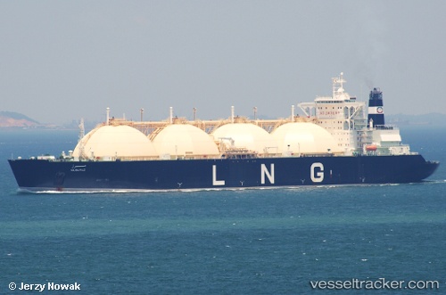
 Mubaraz
Current Status
Where is the vessel?
Mubaraz is currently in 21 nm E of Mirfa, based on AIS data received about 1h ago.
Latest AIS update:
Current position: 25.54550° N, 53.85543° E (21 nm E of Mirfa)
Average speed (last 7 days): Loading…
Average speed (last 30 days): Loading…
Vessel profile: Mubaraz is a Lng Tanker with dimensions 290m x 48m.
This page combines live AIS, route history, probable destination signals, nearby traffic, and port activity for practical vessel monitoring.
The current position of vessel Mubaraz is 25.54550 lat / 53.85543 lng. Updated: 2026-03-28 10:06:58 UTCNearest reference points:
- 11 nm SW of Fateh Terminal
- 16 nm NW of Jebel Ali
- Near Das Island
Currently sailing under the flag of Liberia ![]()
Mubaraz built in 1996 year
Deadweight:
72950 tDetails:
Live Vessel Mubaraz Analytics (details, animations, etc.)
Recent AIS points (UTC):
2026-03-28 03:48:12 UTC · 25.54068, 53.83025 · SOG 9.2 kn · COG 140°2026-03-28 06:04:18 UTC · 25.50365, 53.96861 · SOG 7.9 kn · COG 266°
2026-03-28 07:34:58 UTC · 25.49404, 53.75303 · SOG 8.1 kn · COG 281°
2026-03-28 10:06:58 UTC · 25.54550, 53.85543 · SOG 9.2 kn · COG 114°