 vesseltracker.com
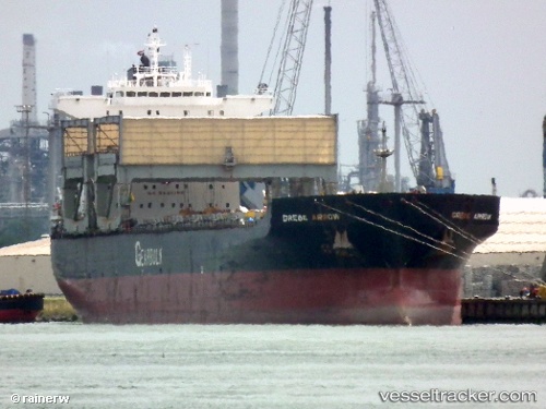
 Grebe Arrow
Current Status
Where is the vessel?
Grebe Arrow is currently in Near STEWART ISLAND, based on AIS data received about 1h ago.
Latest AIS update:
Current position: 46.74925° S, 168.05280° E (Near STEWART ISLAND)
Average speed (last 7 days): Loading…
Average speed (last 30 days): Loading…
Vessel profile: Grebe Arrow is a Multi Purpose Carrier with dimensions 200m x 32m.
This page combines live AIS, route history, probable destination signals, nearby traffic, and port activity for practical vessel monitoring.
The current position of vessel Grebe Arrow is -46.74925 lat / 168.05280 lng. Updated: 2026-04-02 03:27:11 UTCCurrently sailing under the flag of Bahamas ![]()
Grebe Arrow built in 1997 year
Deadweight:
55671 tDetails:
Live Vessel Grebe Arrow Analytics (details, animations, etc.)
Recent AIS points (UTC):
2026-04-01 22:06:11 UTC · -46.74997, 168.05127 · SOG 0 kn · COG 332°2026-04-01 23:24:11 UTC · -46.74982, 168.05153 · SOG 0 kn · COG 327°
2026-04-02 01:48:11 UTC · -46.74950, 168.05232 · SOG 0.1 kn · COG 309°
2026-04-02 03:27:11 UTC · -46.74925, 168.05280 · SOG 0.1 kn · COG 299°