 vesseltracker.com
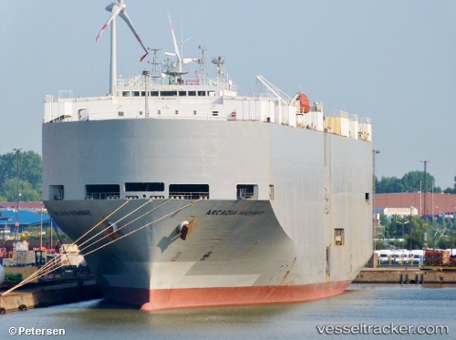
 Arcadia Highway
Current Status
Where is the vessel?
Arcadia Highway is currently in 29 nm E of Benchamas, based on AIS data received about 1h ago.
Latest AIS update:
Current position: 10.51082° N, 101.81047° E (29 nm E of Benchamas)
Average speed (last 7 days): Loading…
Average speed (last 30 days): Loading…
Vessel profile: Arcadia Highway is a Vehicles Carrier with dimensions 179m x 32m.
This page combines live AIS, route history, probable destination signals, nearby traffic, and port activity for practical vessel monitoring.
The current position of vessel Arcadia Highway is 10.51082 lat / 101.81047 lng. Updated: 2026-03-29 05:43:18 UTCNearest reference points:
- 43 nm E of Benchamas
- 63 nm NW of Dai Hung (STS Load)
- 43 nm SW of Chanthaburi
Currently sailing under the flag of Panama ![]()
Arcadia Highway built in 1995 year
Deadweight:
15507 tDetails:
Live Vessel Arcadia Highway Analytics (details, animations, etc.)
Recent AIS points (UTC):
2026-03-28 01:17:58 UTC · 5.97003, 103.68508 · SOG 11.1 kn · COG 340°2026-03-29 00:21:39 UTC · 9.80303, 102.15817 · SOG 10.9 kn · COG 335°
2026-03-29 03:34:18 UTC · 10.16288, 101.98173 · SOG 10.7 kn · COG 335°
2026-03-29 05:43:18 UTC · 10.51082, 101.81047 · SOG 10.9 kn · COG 337°