 vesseltracker.com
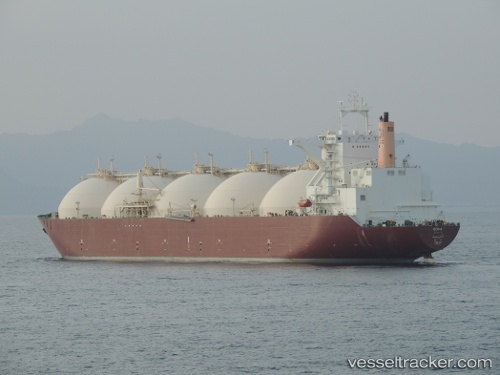
 DOHA
DOHA
Current Status
Where is the vessel?
DOHA is currently in 15 nm SW of Kiamari, based on AIS data received about 9h ago.
Latest AIS update:
Current position: 24.63319° N, 66.77549° E (15 nm SW of Kiamari)
Average speed (last 7 days): Loading…
Average speed (last 30 days): Loading…
Vessel profile: DOHA is a LNG Tanker with dimensions 297m x 46m.
This page combines live AIS, route history, probable destination signals, nearby traffic, and port activity for practical vessel monitoring.
The current position of vessel DOHA is 24.63319 lat / 66.77549 lng. Updated: 2026-04-10 07:21:37 UTCNearest reference points:
- 16 nm S of Kiamari
- Near Kiamari
- Near PORT QASIM
Currently sailing under the flag of Marshall Islands ![]()
DOHA built in 1999 year
Deadweight:
72337 tDetails:
Live Vessel DOHA Analytics (details, animations, etc.)
Recent AIS points (UTC):
2026-04-10 01:48:38 UTC · 24.63055, 66.77873 · SOG 0 kn · COG 278°2026-04-10 03:34:49 UTC · 24.63024, 66.77868 · SOG 0 kn · COG -1°
2026-04-10 05:57:36 UTC · 24.62879, 66.77620 · SOG 0.1 kn · COG 5°
2026-04-10 07:21:37 UTC · 24.63319, 66.77549 · SOG 0.2 kn · COG 161°