 vesseltracker.com
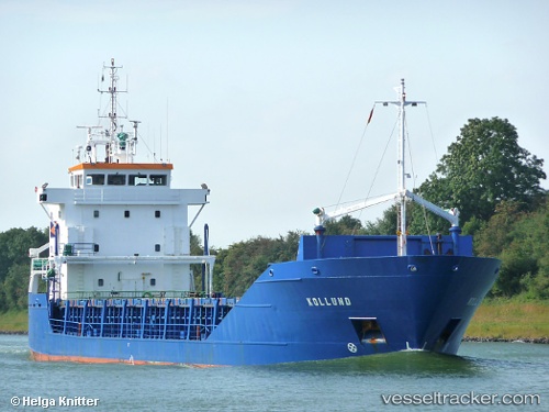
 Tollund
Current Status
Where is the vessel?
Tollund is currently in Near Tetney Terminal, based on AIS data received less than 1h ago.
Latest AIS update:
Current position: 53.54184° N, 0.26349° E (Near Tetney Terminal)
Average speed (last 7 days): Loading…
Average speed (last 30 days): Loading…
Vessel profile: Tollund is a Multi Purpose Carrier with dimensions 91m x 13m.
This page combines live AIS, route history, probable destination signals, nearby traffic, and port activity for practical vessel monitoring.
The current position of vessel Tollund is 53.54184 lat / 0.26349 lng. Updated: 2026-04-09 22:01:12 UTCNearest reference points:
- Near Withernsea
- Near Grimsby
- Near Immingham
Currently sailing under the flag of Poland ![]()
Tollund built in 1994 year
Deadweight:
4170 tDetails:
Live Vessel Tollund Analytics (details, animations, etc.)
Recent AIS points (UTC):
2026-04-09 15:31:41 UTC · 53.57882, -0.07490 · SOG 0 kn · COG 29°2026-04-09 18:16:41 UTC · 53.57884, -0.07495 · SOG 0 kn · COG 29°
2026-04-09 19:19:41 UTC · 53.57881, -0.07487 · SOG 0 kn · COG 28°
2026-04-09 22:01:12 UTC · 53.54184, 0.26349 · SOG 9.6 kn · COG 86°