 vesseltracker.com
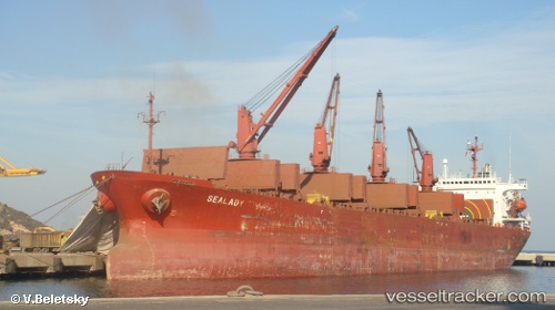
 SEA MERAY
Current Status
Where is the vessel?
SEA MERAY is currently in Near DORTYOL, based on AIS data received less than 1h ago.
Latest AIS update:
Current position: 36.78605° N, 36.13980° E (Near DORTYOL)
Average speed (last 7 days): Loading…
Average speed (last 30 days): Loading…
Vessel profile: SEA MERAY is a Bulk Carrier with dimensions m x m.
This page combines live AIS, route history, probable destination signals, nearby traffic, and port activity for practical vessel monitoring.
The current position of vessel SEA MERAY is 36.78605 lat / 36.13980 lng. Updated: 2026-03-31 03:29:03 UTCNearest reference points:
- Near DORTYOL
- Near Iskenderun
- Near CEYHAN
Currently sailing under the flag of Guinea ![]()
Details:
Live Vessel SEA MERAY Analytics (details, animations, etc.)
Recent AIS points (UTC):
2026-03-30 21:22:52 UTC · 36.78630, 36.13921 · SOG 0.1 kn · COG 191°2026-03-30 23:37:55 UTC · 36.78608, 36.13953 · SOG 0.1 kn · COG 207°
2026-03-31 02:29:01 UTC · 36.78604, 36.13980 · SOG 0.1 kn · COG 220°
2026-03-31 03:29:03 UTC · 36.78605, 36.13980 · SOG 0.1 kn · COG 212°