 vesseltracker.com
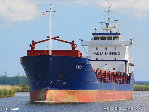
 KAILI
KAILI
Current Status
Where is the vessel?
KAILI is currently in Near Rødbyhavn, based on AIS data received less than 1h ago.
Latest AIS update:
Current position: 54.60528° N, 11.18359° E (Near Rødbyhavn)
Average speed (last 7 days): Loading…
Average speed (last 30 days): Loading…
Vessel profile: KAILI is a General Cargo with dimensions m x m.
This page combines live AIS, route history, probable destination signals, nearby traffic, and port activity for practical vessel monitoring.
The current position of vessel KAILI is 54.60528 lat / 11.18359 lng. Updated: 2026-03-29 09:58:57 UTCNearest reference points:
- Near Grossenbrode
- Near BURGSTAAKEN
- Near SPODSBJERG
Currently sailing under the flag of Antigua and Barbuda ![]()
Details:
Live Vessel KAILI Analytics (details, animations, etc.)
Recent AIS points (UTC):
2026-03-29 04:18:13 UTC · 54.70754, 12.50544 · SOG 10 kn · COG 232°2026-03-29 06:11:34 UTC · 54.47174, 12.17034 · SOG 9.6 kn · COG 196°
2026-03-29 07:56:37 UTC · 54.45523, 11.70219 · SOG 10 kn · COG 293°
2026-03-29 09:58:57 UTC · 54.60528, 11.18359 · SOG 10.3 kn · COG 260°