 vesseltracker.com
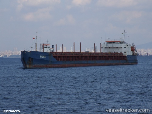
 SIOUX
SIOUX
Current Status
Where is the vessel?
SIOUX is currently in 11 nm N of INEBOLU, based on AIS data received less than 1h ago.
Latest AIS update:
Current position: 42.15879° N, 33.74593° E (11 nm N of INEBOLU)
Average speed (last 7 days): Loading…
Average speed (last 30 days): Loading…
Vessel profile: SIOUX is a General Cargo with dimensions m x m.
This page combines live AIS, route history, probable destination signals, nearby traffic, and port activity for practical vessel monitoring.
The current position of vessel SIOUX is 42.15879 lat / 33.74593 lng. Updated: 2026-04-07 21:56:07 UTCNearest reference points:
- 18 nm NW of INEBOLU
- 27 nm NW of INEBOLU
- Near Cide
Currently sailing under the flag of Liberia ![]()
Details:
Live Vessel SIOUX Analytics (details, animations, etc.)
Recent AIS points (UTC):
2026-04-07 15:44:11 UTC · 42.26167, 34.58500 · SOG 6 kn · COG -1°2026-04-07 16:23:15 UTC · 42.21333, 34.52667 · SOG 5 kn · COG -1°
2026-04-07 19:25:53 UTC · 42.16616, 34.13720 · SOG 6.4 kn · COG -1°
2026-04-07 21:56:07 UTC · 42.15879, 33.74593 · SOG 7.6 kn · COG -1°