 vesseltracker.com
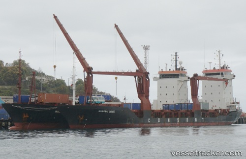
Ocean Freedom
Current StatusWhere is the vessel?
Ocean Freedom is currently in 13 nm S of GENERAL SANTOS, based on AIS data received about 17h ago.
Latest AIS update:
Current position: 5.87479° N, 125.12457° E (13 nm S of GENERAL SANTOS)
Average speed (last 7 days): Loading…
Average speed (last 30 days): Loading…
Vessel profile: Ocean Freedom is a Multi Purpose Carrier with dimensions 16m x 105m.
This page combines live AIS, route history, probable destination signals, nearby traffic, and port activity for practical vessel monitoring.
The current position of vessel Ocean Freedom is 5.87479 lat / 125.12457 lng. Updated: 2026-04-01 16:07:54 UTCNearest reference points:
- Near DICT / SVT
- 48 nm N of Melonguanne
Details:
Live Vessel Ocean Freedom Analytics (details, animations, etc.)
Recent AIS points (UTC):
2026-04-01 15:54:17 UTC · 5.90564, 125.13268 · SOG 8.1 kn · COG 195°2026-04-01 16:07:54 UTC · 5.87479, 125.12457 · SOG 8.3 kn · COG -1°
2026-04-01 16:07:54 UTC · 5.87479, 125.12457 · SOG 8.3 kn · COG -1°
2026-04-01 16:07:54 UTC · 5.87479, 125.12457 · SOG 8.3 kn · COG -1°