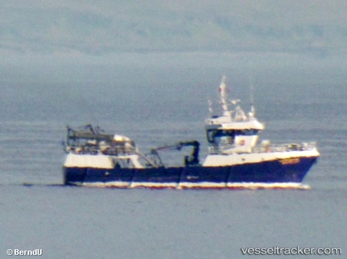
.
Vessel photo of Liinahamari (IMO 9123207) vesseltracker.com

Liinahamari

Vessel type: Fish Carrier | IMO: 9123207 | MMSI: MMSI: 273358500
Call sign: UBJG4 | Dimensions: 8 m x 32 m
Current Status

Where is the vessel?

Liinahamari is currently in Near Pechenga, based on AIS data received about 241d ago.

Latest AIS update:

Current position: 69.64592° N, 31.37776° E (Near Pechenga)

Average speed (last 7 days): Loading…

Average speed (last 30 days): Loading…

Vessel profile: Liinahamari is a Fish Carrier with dimensions 8m x 32m.

This page combines live AIS, route history, probable destination signals, nearby traffic, and port activity for practical vessel monitoring.

The current position of vessel Liinahamari is 69.64592 lat / 31.37776 lng. Updated: 2025-07-31 05:42:41 UTC
Nearest reference points:
  • Near Ozerko
  • 15 nm W of Murmansk
  • Near Ura-Guba
Details:

Live Vessel Liinahamari Analytics (details, animations, etc.)


Recent AIS points (UTC):
2025-07-31 05:42:41 UTC · 69.64592, 31.37776 · SOG 2.1 kn · COG 1°

Track of the vessel in the last 28 days


UTC: --
Start: -- Track timeline (UTC) End: --
Encountered: --


Link to the map:


Find another ship

Liinahamari (273358500) last ports (portcalls and passsages)

Pechenga | 2025-07-31 05:34:46
Murmansk | 2025-06-02 17:53:18
Murmansk | 2025-05-28 07:38:10
Polyarnyy | 2025-05-28 02:23:14
Pechenga | 2025-05-27 03:41:12
Murmansk | 2024-06-11 11:08:54
Murmansk | 2024-06-07 10:55:59
Polyarnyy | 2024-06-03 11:40:08
Murmansk | 2024-06-03 10:47:52
Murmansk | 2024-05-30 10:26:13
Murmansk | 2024-05-26 08:52:36
Polyarnyy | 2024-05-26 06:28:42
Murmansk | 2023-12-24 08:39:39
Murmansk | 2023-12-20 08:33:29
Murmansk | 2023-12-16 08:25:24
Polyarnyy | 2023-12-16 07:46:41
Murmansk | 2023-10-01 06:23:29
Murmansk | 2023-09-27 04:30:47
Polyarnyy | 2023-09-27 02:24:21
Murmansk | 2023-08-18 10:26:45
Murmansk | 2023-08-14 09:26:04
Murmansk | 2023-07-12 06:31:38
Polyarnyy | 2023-07-12 04:04:29
Pechenga | 2023-04-05 17:13:39
Pechenga | 2022-12-25 17:35:53