 vesseltracker.com
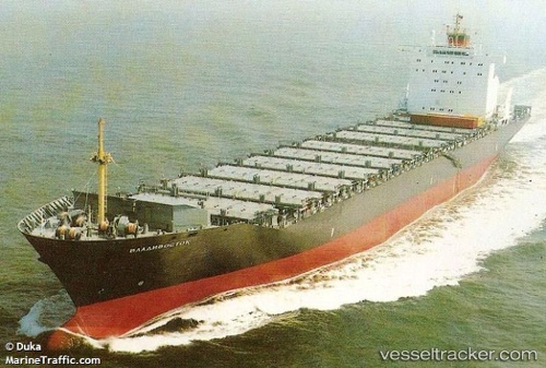
 VLADIVOSTOK
Current Status
Where is the vessel?
VLADIVOSTOK is currently in 67 nm S of Seogwipo, based on AIS data received about 6h ago.
Latest AIS update:
Current position: 32.12667° N, 126.65833° E (67 nm S of Seogwipo)
Average speed (last 7 days): Loading…
Average speed (last 30 days): Loading…
Vessel profile: VLADIVOSTOK is a Container Ship with dimensions m x m.
This page combines live AIS, route history, probable destination signals, nearby traffic, and port activity for practical vessel monitoring.
The current position of vessel VLADIVOSTOK is 32.12667 lat / 126.65833 lng. Updated: 2026-04-10 07:17:24 UTCNearest reference points:
- 75 nm S of Hwasun
- 78 nm S of Seogwipo
- 66 nm S of Hwasun
Currently sailing under the flag of Sierra Leone ![]()
Details:
Live Vessel VLADIVOSTOK Analytics (details, animations, etc.)
Recent AIS points (UTC):
2026-04-10 00:44:26 UTC · 30.84167, 125.48167 · SOG 15 kn · COG -1°2026-04-10 03:54:56 UTC · 31.49686, 126.01238 · SOG 15 kn · COG 27°
2026-04-10 05:45:19 UTC · 31.82396, 126.38089 · SOG 14.7 kn · COG 26°
2026-04-10 07:17:24 UTC · 32.12667, 126.65833 · SOG 15 kn · COG -1°