 vesseltracker.com
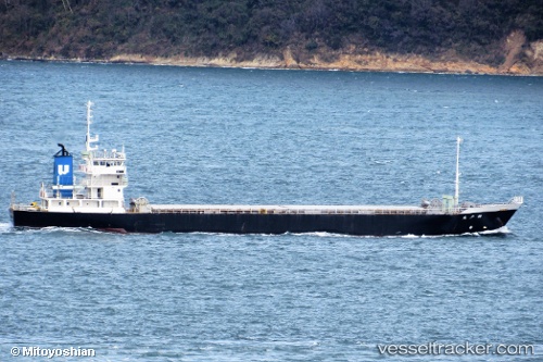
 HTS 23
Current Status
Where is the vessel?
HTS 23 is currently in 34 nm W of Kassue, based on AIS data received about 3d ago.
Latest AIS update:
Current position: 6.88241° S, 138.65636° E (34 nm W of Kassue)
Average speed (last 7 days): Loading…
Average speed (last 30 days): Loading…
Vessel profile: HTS 23 is a General Cargo Ship with dimensions 87m x 87m.
This page combines live AIS, route history, probable destination signals, nearby traffic, and port activity for practical vessel monitoring.
The current position of vessel HTS 23 is -6.88241 lat / 138.65636 lng. Updated: 2026-04-09 04:40:11 UTCNearest reference points:
- 33 nm SE of Kassue
- 34 nm NW of MERAUKE
- 40 nm SE of Pomako
Currently sailing under the flag of Indonesia ![]()
HTS 23 built in 1996 year
Deadweight:
2100 tDetails:
Live Vessel HTS 23 Analytics (details, animations, etc.)
Recent AIS points (UTC):
2026-04-09 00:11:15 UTC · -6.88146, 138.65401 · SOG 2.2 kn · COG -1°2026-04-09 04:40:11 UTC · -6.88241, 138.65636 · SOG 0.2 kn · COG -1°
2026-04-09 04:40:11 UTC · -6.88241, 138.65636 · SOG 0.2 kn · COG -1°
2026-04-09 04:40:11 UTC · -6.88241, 138.65636 · SOG 0.2 kn · COG -1°