 vesseltracker.com
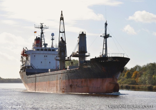
 STAR
STAR
Current Status
Where is the vessel?
STAR is currently in Near Tartous, based on AIS data received about 1d ago.
Latest AIS update:
Current position: 34.89345° N, 35.82838° E (Near Tartous)
Average speed (last 7 days): Loading…
Average speed (last 30 days): Loading…
Vessel profile: STAR is a General Cargo with dimensions m x m.
This page combines live AIS, route history, probable destination signals, nearby traffic, and port activity for practical vessel monitoring.
The current position of vessel STAR is 34.89345 lat / 35.82838 lng. Updated: 2026-04-10 07:04:28 UTCNearest reference points:
- Near Tartous
- Near Tripoli
- Near Al Ladhiqiyah
Currently sailing under the flag of Togo ![]()
Details:
Live Vessel STAR Analytics (details, animations, etc.)
Recent AIS points (UTC):
2026-04-10 02:16:29 UTC · 34.89320, 35.82838 · SOG 0.4 kn · COG 216°2026-04-10 03:45:56 UTC · 34.89326, 35.82837 · SOG 0.4 kn · COG 214°
2026-04-10 05:31:27 UTC · 34.89339, 35.82830 · SOG 0.3 kn · COG 219°
2026-04-10 07:04:28 UTC · 34.89345, 35.82838 · SOG 0.6 kn · COG 210°